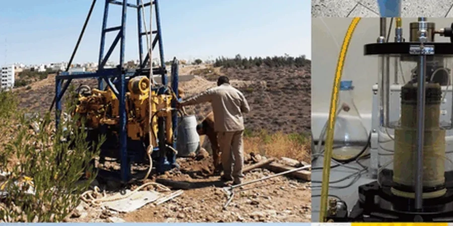
In Tampa, the limestone bedrock doesn't sit flat. It dissolves, fractures, and drops. We've mapped profiles across Westchase where the karst surface varies 40 feet over a 100-foot horizontal run. Standard borings miss that. Seismic tomography captures the velocity contrast between intact limestone, weathered rock, and loose overburden — data you can't get from a drill log alone. Whether you're siting a warehouse near the port or adding a wing to a hospital in Hyde Park, knowing the true geometry of the rockhead determines foundation type, cost, and schedule. We pair this with CPT soundings when soft clay layers between sand and limestone need continuous stratigraphy.
Karst in Tampa is not a single surface — it's a zone. Tomography shows you the top, the bottom, and the anomalies in between.
Methodology applied in Tampa Florida
Local geotechnical conditions in Tampa Florida
Florida's dry season — November through May — is the window for clean seismic data here. Summer rains saturate the shallow soils, attenuating high frequencies and degrading first-break picks. A survey run in August after a week of afternoon thunderstorms will show a muted refractor and higher RMS misfit. We schedule around this. Another Tampa-specific risk: cultural noise. Urban sites near I-275, Dale Mabry, or active construction zones produce ground vibration that overwrites weak arrivals. Our crew runs night surveys or weekend windows when ambient noise drops, and we stack shots to improve signal-to-noise. Underground utilities — especially buried electrical conduits in downtown Tampa — can also short geophone coupling. We hand-auger pilot holes to verify clearance before planting the spread.
Our services
Our Tampa seismic tomography work feeds directly into geotechnical design. The deliverables are not just velocity sections — they answer the questions your structural engineer and geotechnical consultant need resolved.
Karst & Sinkhole Mapping
Identify paleo-sinkholes, raveling zones, and pinnacled rock surfaces that threaten differential settlement. Combined with limited borings, tomography reduces the number of probe holes while improving lateral coverage.
Rippability & Excavation Assessment
Seismic velocity directly correlates to rock strength. We classify limestone and chert layers by rippability, helping contractors price earthwork accurately before a single machine hits the site.
Vs30 & Seismic Site Class
Measure shear-wave velocity to 100 feet for IBC site classification. Required for essential facilities, schools, and structures in seismic design category C and above per ASCE 7-22.
Common questions
What depth can seismic tomography reach in Tampa's geology?
With refraction and a sledgehammer source, we typically resolve the top 80 to 120 feet — enough to map the overburden-to-limestone transition across most of Hillsborough County. For deeper targets, like confirming the integrity of the Floridan aquifer confining unit below 150 feet, we deploy seismic reflection with a weight-drop source. The actual depth depends on velocity structure and ambient noise at the specific site.
How long does a survey take, and what access do you need?
A standard 24-channel refraction line — roughly 230 to 460 feet long — takes half a day including setup, shooting, and breakdown. We need a cleared swath about 10 feet wide along the line. For multi-line grids, plan on one to two field days. Processing and interpretation add three to five business days. Urban sites with heavy traffic may require night work, which we coordinate with the city and your site manager.
What does a seismic tomography survey cost in the Tampa area?
A single-line refraction survey with tomographic processing typically runs between $2,380 and $5,510 depending on line length, number of shots, and site conditions. Multi-line grids, reflection surveys, or projects requiring night crews and traffic control fall toward the upper end. Every proposal includes mobilization, field acquisition, processing, and a signed report with interpreted cross-sections.
Does tomography replace borings for sinkhole investigation?
No — it complements them. Tomography provides continuous lateral coverage between borings, catching anomalies a 4-inch borehole can miss. The standard practice in Tampa is to calibrate the velocity model with at least one boring, then use the seismic data to interpolate the rock surface and identify low-velocity zones that may indicate raveling or incipient sinkholes. The combination gives you far more confidence than either method alone.